
The National Hurricane Center has flagged an area of interest in the Bay of Campeche, near Mexico, for potential tropical development. The chances of development are low – and there is no threat to Florida. A westward-moving tropical wave over Mexico's Yucantan Peninsula is expected to move over the Bay of Campeche as early as Friday, where environmental conditions are "marginally conducive" for tropical development. Currently, the NHC has given it a low – or 10% chance – of development over the next 7 days. This area of low pressure is related to the remnants of Tropical Storm Cristina in the Pacific Ocean, which weakened to a weak trough of low pressure near the Coast of Salvador on Thursday. That system is expected to cross Central America into the Gulf, and then move inland over eastern Mexico late Saturday or Sunday. 2026 Atlantic Hurricane Season The Atlantic hurricane season runs June 1 - November 30. The most active months are typically between August, September, and October. The Atlantic season actually has two peaks: mid-September and mid-October, though activity tends to drop quickly after the second peak. El Nino and hurricane season Both NOAA and Colorado State University have released their tropical outlooks for the 2026 hurricane season, predicting a below-average season largely due to El Nino. On Thursday, the National Weather Service Climate Prediction Center issued an El Eino Advisory, declaring that El Niño conditions had arrived in the Northern Hemisphere, and were expected to strengthen. Average hurricane season: 15 named storms, 7 hurricanes, 3 major hurricanes Colorado State University (June 10): 11 named storms, 5 hurricanes, 2 major hurricanes NOAA: 8-14 named storms, 3-6 hurricanes, 1-3 major hurricanes. What is El Niño? El Niño is the warm phase of a natural climate pattern called ENSO, short for El Niño...
NHC tracking tropical wave in Bay of Campeche; no Florida threat
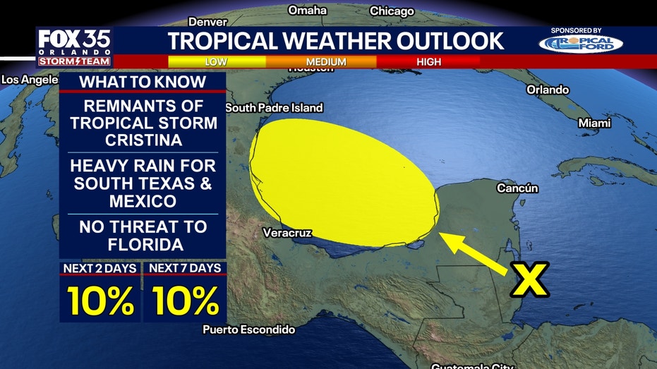
Source: Fox 35 Orlando
Read Full Story →