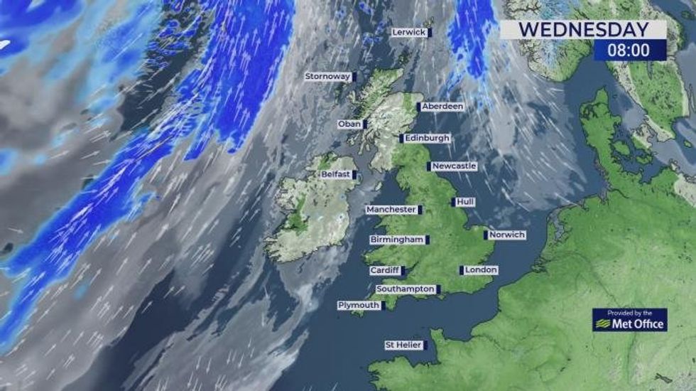
Britons should make the most of one of the warmest April spells on record before the heavens unleash a thundery deluge. Temperatures in southern Britain could hit 27C today, beating the 24.4C record for April 8th set in London, in 1894. But change is afoot ahead of the weekend, as a sweeping cold front from the west to plummets the mercury. With cooler winds will come electrical downpours loaded with thundery rain and lightning. TRENDING Stories Videos Your Say Met Office meteorologist Liam Eslick said: “There is plenty of sunshine, and as we go into Wednesday, high pressure has influence over the UK, and we will cling onto clearer skies across the southern half of the UK. “Temperatures are on the rise, and we are looking at 23C or 24C, and we could see a possible 25C or an isolated 26C by the back end of the afternoon. “It is going to turn a bit wetter and cooler as we head towards Thursday afternoon, and temperatures will be down quite a few degrees with a number of showers, and some of these are likely to be heavy with even see the odd rumble of thunder or flash of lightning.” The Met Office said 27C in an isolated spot in the south by late afternoon would not be out of the question. High pressure to the east of the UK will sweep a plume of warm air in from North Africa. Temperatures are expected to peak today with widespread highs across southern Britain in the low-20Cs. Northern and northwestern regions will be cooler with a greater chance of rain, but most of Britain will enjoy the warmest day of the year so far. But high pressure will give way to low pressure ahead of the weekend, and the return of cooler...
Britain set for one of the warmest April spells on record as temperatures reach 27C
Source: Gb News
Read Full Story →